A notebook of half-day walks, map reading and kit care Sheet 00 · illustrative terrain throughout
Field Hours

Terrain · sub-section · 2 notes

Contours

What the brown lines are drawing: four basic shapes, and how the gaps between lines turn into slope.

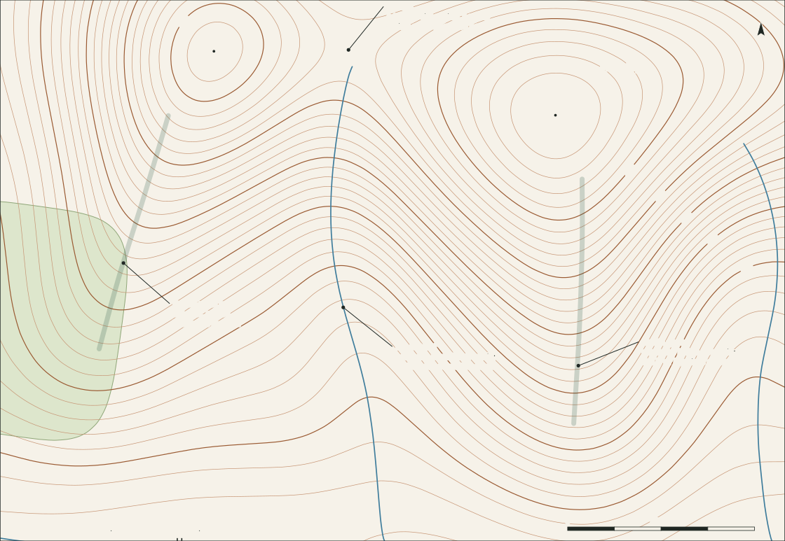
A contour joins points of equal height. One line says little; a set of them, read together, is a picture of the hill.

The first note here is about pattern — telling a spur from a re-entrant, and finding the saddle between two tops. The second is about spacing: how far apart the lines sit, and what angle of ground that stands for.

Both are worked on Sheet 00, which is drawn with a 10 m contour interval and a heavier index contour every 50 m.

Note 05 · 3 min read

Spurs and re-entrants

The same bend in a contour line can be a ridge or a valley. Which one it is depends on a single question: where is downhill?

  • Spur: contour bends point downhill.
  • Re-entrant: bends point uphill; streams run in them.
  • Saddle: an hourglass of contours between two tops.
Read the note

Note 06 · 3 min read

Contour spacing and slope

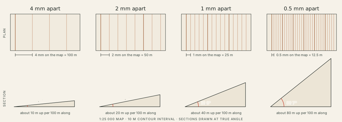
How far apart the lines sit is a measurement, not an impression. A small lookup table turns millimetres on the map into degrees on the ground.

  • 1:25 000 map: 1 mm = 25 m on the ground.
  • 10 m contours 1 mm apart: about 22°.
  • Sample loop: no leg averages more than 7°; steepest 100 m is 9.5°.

Read the note