A notebook of half-day walks, map reading and kit care Sheet 00 · illustrative terrain throughout
Field Hours

Terrain · sub-section · 2 notes

Route Reading

Turning shapes into a line that can be followed: features to walk along, features to stop at, and the route seen side-on.

Knowing the shapes is half of it. The other half is choosing which features to lean on, so that staying on route does not depend on staring at a compass.

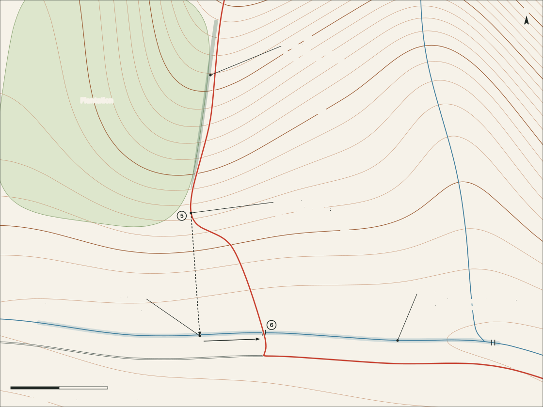
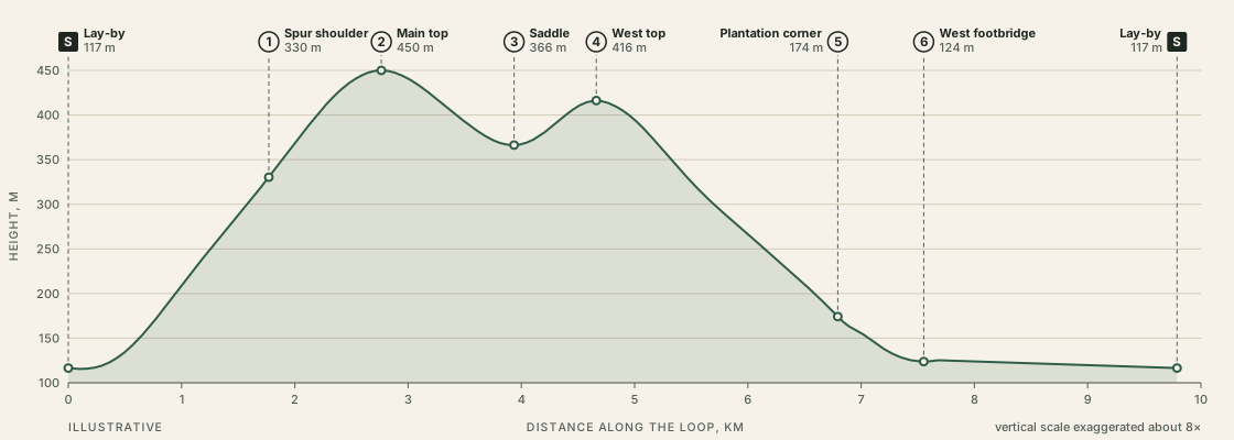
The first note works through the standard vocabulary — handrails, catching features, attack points, aiming off — on one descent of the sample loop. The second reads the whole loop as a profile and asks what that view adds and what it hides.

Note 07 · 4 min read

Handrails, catching features, attack points

Four ordinary navigation ideas, worked through on one descent: something to follow, something to stop at, somewhere to start being careful.

  • Handrail: a line feature going your way.
  • Catching feature: a line feature across your way, beyond the target.
  • Attack point: an obvious spot near the target.
Read the note

Note 08 · 4 min read

Reading a profile

A route seen side-on shows where the effort falls. It also exaggerates, and leaves out nearly everything else.

  • 87% of the climb comes in the first 2.8 km.
  • High point at 29% of the distance, 43% of the moving time.
  • The chart’s vertical scale is stretched about 8×.

Read the note